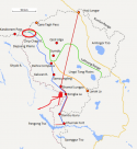
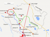
Out of the entire stretch between blue and pink dotted, there
may be Chinese bases which indicate Chinese control, at the very top end of the entire dispute. And even then, this is a section that approaches a corner that tapers in.
There's also the road I suppose but again that's very recently built. The other "bases" were built in 2010 onwards and the earliest one 2004 is on the very top end, that's basically the blue line.
In any case, I said before, Depsang is considered by India to be unresolved stand off.
That d-atis map does not prove that China has had any real control over the disputed region during status quo era. It had some bases right next to the blue line at the very top end of the dispute at a part of Depsang. That doesn't mean it controlled Gogra or F4 to F8.
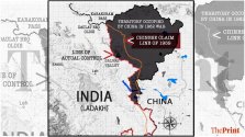
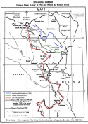
In your desparation to find evidence of China losing territory and India gaining, none of that counts. If China has lost anything east of blue line, then yes you're correct. Everything between dotted and blue line is the current dispute and China had no real control over any significant parts of it. China's build a road and got some bases at the tip of dispute at Depsang. shown below.

Red line from F5 to F8 and circle at tip where alleged Chinese bases constructed at 2004 and after 2010 are. Not much control when everything else is east of blue line.
The road was a recent construction and what also set India off towards building up and increasing patrols.


