PLAN SCS Bases/Islands/Vessels (Not a Strategy Page)

joshuatree

Captain
Who or what organization has been publishing these photos that first appear on Chinese websites? Is there a Chinese Digital Globe?

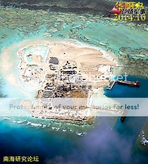
It appears that early schematics showing a preserved lake in the middle of the base were incorrect. Yet China does appear to be preserving the small dredged canal at the original base.

I would guess because construction is not complete, the small dock at the original base is still needed to resupply the garrison there. As for lake in the middle, I always found that suspicious, why would they need a lake in the SCS? Land is the precious commodity here. Holding freshwater doesn't seem ideal since all the land is reclaimed, I doubt any water kept in there will be fresh, more like brackish. Storage tanks would make more sense.
 

A.Man

Major
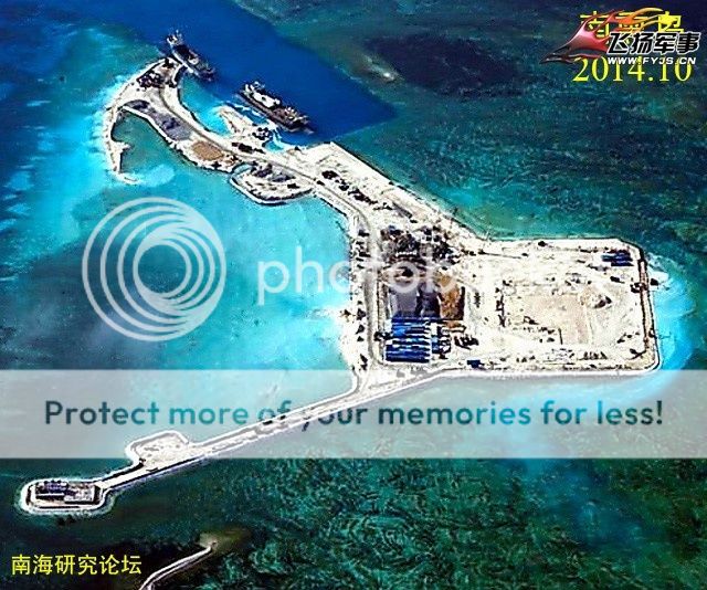
南薰礁(Nanxun Jiao)or Gaven Reef, Oct. 2014

135348godufadl5hwrdw5j_zpsafjthvl8.jpg~original


华阳礁 (Huayang Jiao) or Cuarteron Reef, Oct. 2014

135429a67yy46yk3yp2r64_zpssvbo4ro6.jpg~original
 
Last edited:

no_name

Colonel
Who or what organization has been publishing these photos that first appear on Chinese websites? Is there a Chinese Digital Globe?

It appears that early schematics showing a preserved lake in the middle of the base were incorrect. Yet China does appear to be preserving the small dredged canal at the original base.

Bottom of the picture tells you it's from a forum that is dedicated to South China Sea developments.
 

Geographer

Junior Member
Bottom of the picture tells you it's from a forum that is dedicated to South China Sea developments.
Does the forum own the airplane or satellite that takes the photos? Which organization takes the original photos?
 

no_name

Colonel
I don't know but it does not seem to be a government related forum.

You can visit it for yourself:

Please, Log in or Register to view URLs content!


I've only known about this site after finding the photo in the previous post. Google translate of the front page looks adequate.
 

joshuatree

Captain
What do you all think the final base layout will be? They appear to be expanding the top branch downwards so they could be making a triangle shaped island. On the other hand, the bottom branch appears complete.

The bottom connects the original structure to the newly created island which is probably the only reason why the island is laid out as is. Maybe the original location will eventually be a position for a lighthouse. Seems they built this island further in on the reef, perhaps local tide patterns are rather rough at this location?
 
Top