Ladakh Flash Point

Status
Not open for further replies.

ougoah

Brigadier
Registered Member
Someone in IDF posted these latest Hot Springs and Gorga from Google Earth images.

View attachment 70056
View attachment 70057
View attachment 70058View attachment 70059
View attachment 70060

Are there dates on these images? Could have been from early 2020 for all we know. When was the last time Google Earth updated their images and when were these particular images gathered?

As of now, for all we know, there could have been greater pull back of forces but there hasn't been an update from either side to announce stand-off at Gogra HS, Demchok etc have disengaged. So it's probably the same stone's throw away from each other scenario at most of those points.
 

jfy1155

Junior Member
Registered Member
Are there dates on these images? Could have been from early 2020 for all we know. When was the last time Google Earth updated their images and when were these particular images gathered?

As of now, for all we know, there could have been greater pull back of forces but there hasn't been an update from either side to announce stand-off at Gogra HS, Demchok etc have disengaged. So it's probably the same stone's throw away from each other scenario at most of those points.
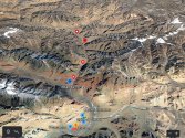
Feb 2021
 

twineedle

Junior Member
Registered Member
Are there dates on these images? Could have been from early 2020 for all we know. When was the last time Google Earth updated their images and when were these particular images gathered?

As of now, for all we know, there could have been greater pull back of forces but there hasn't been an update from either side to announce stand-off at Gogra HS, Demchok etc have disengaged. So it's probably the same stone's throw away from each other scenario at most of those points.
It seems like there are both an Indian and Chinese camp still in the area represented by the circle in that image by Detresfa, although he said both sides had disengaged there. Looks like the majority of Indian and Chinese camps and structures were disengaged with just those camps remaining, though China still has heavy artillery and base camps on its side. I guess that is the area the Indian MOD and Adm. Davidson was referring to. Although it looks like those images do seem to contradict Shukla's claims, since he wrote that China had transgressed 3-4 km and blocked several pps, although those images show pp15-19 well behind Indian positions.

interestingly, it looks like the opposite is true of Gogra. The images of Gogra appear to be Indian mirror deployments east of the permanent base, and it looks like there was a heavy buildup before India started pulling back, perhaps due to winter or maybe even as part of the first step in disengagement in the area.

Important to note that the area in the first image is disputed, though there have not been any stand offs there since 1962. Though I will admit if those images are true, I was mistaken about Chinese camps not being in areas India claims, and about Indian army and PLA no longer being in eyeball-to eyeball confrontations. Of course, the Indian camp is right across and in the same area both sides claim.
 

ougoah

Brigadier
Registered Member

Mirror deployment and build up, mirror your disengagement if you want status quo restored. Pangong side is a great example of this working. China annoyed at Indian build up and patrolling -> deployment of PLA -> India wants PLA disengaged, has to remove original source of irritation to China i.e. no Indian build up and patrols -> India goes and stays behind F3 -> China disengages PLA.

Now for Demchok, Gogra HS, and the hinted at ongoing stand-off at Depsang (not sure how true this one is), a similar path to disengagement should be pursued. Has China any real strategic interest in keeping a foot just a few kilometers into disputed land? No don't listen to the likes of Gandhi Sukhla etc. They think a few kilometers of forward position is some militarily relevant tactic. It is not anymore. This implies China must surely be willing to disengage. If it weren't there would be no talks and negotiations.

China wants something from India just like at Pangong disengagement conditions. India must be refusing whatever the demands are for these sections to still be in this sort of stand-off.

Again I want to make it clear that if China's intention from the beginning was to "capture" disputed land for good and control them for keeps, they would not bother formally negotiate with Indians and negotiate at such high levels for so long. Clearly there are real strategic objectives beyond simply holding "tactically important" observation points so many higher profile Indians like to mention. This clearly isn't about gaining and losing strategic vantage points in the era of technology and warfare won and lost by drones.

China never captured F4 to F8 with the intention of keeping them, if they did, they wouldn't have talked with India and wouldn't have agreed to have Russia be some intermediary between the two for more productive negotiations. The Chinese got what they wanted from the Indians at Pangong. They haven't yet for Depsang, Gogra, Demchok which is why those points are considered still as stand-offs and the Indian gov itself has stated this as such since mid February. If India works with China diplomatically, there would no doubt be disengagement along all positions forward of the blue line.

However India agreed to a pretty high price for PLA disengagement at Pangong. This suggests to me that India is reasonable with China behind the media and public talk. They are not agreeing to total disengagement at those other sections possibly because the Chinese conditions are even more demanding on the Indian side than what was done at Pangong lake.

Keep in mind that India formally still claims F3 to F8, all of Demchok, and even wants to control Aksai Chin. Perhaps the conditions for total military disengagement has a lot to do with India formally dropping claims? At least getting them to totally drop claims on Aksai Chin.
 

Xizor

Captain
Registered Member
Although it looks like those images do seem to contradict Shukla's claims, since he wrote that China had transgressed 3-4 km and blocked several pps, although those images show pp15-19 well behind Indian positions.
Where does it contradict? Can you show?
 

Xizor

Captain
Registered Member
I have tagged all the places pointed out in those maps from IDF.

Annotation 2021-03-19 094402.jpg

Seems like Hot Springs is still an issue. ( Assuming the maps are upto date).

Although it looks like those images do seem to contradict Shukla's claims, since he wrote that China had transgressed 3-4 km and blocked several pps, although those images show pp15-19 well behind Indian positions.
@twineedle where does it show Ajai Skukla claims were debunked? If anything, assuming these maps are current, his claims strengthened.

Ajai Shukla's claims are easy to be disproven. Sadly, you never get into that matter.
 
Last edited:

twineedle

Junior Member
Registered Member

I have tagged all the places pointed out in those maps from IDF.

View attachment 70069

Seems like Hot Springs is still an issue. ( Assuming the maps are upto date).


@twineedle where does it show Ajai Skukla claims were debunked? If anything, assuming these maps are current, his claims strengthened.

Ajai Shukla's claims are easy to be disproven. Sadly, you never get into that matter.
First of all, Shukla claimed the chinese incursion was 3-4 km. However, there is only one camp about 1.5 km within Indian claims, and there is also an indian camp right across from that. The Indian camp is also EAST of pp15, 16, and 17 as per his map.

And in Gogra, there are no signs of any PLA presence in the areas India claims. Instead, it shows India forward deployments EAST of Gogra post, near points 18, 19, and 20. Also, you have mapped gogra incorrectly, gogra is east of the bend of the CHang Chenmo river,

Please, Log in or Register to view URLs content!


So basically, from those images:
No PLA presence near Gogra(pps 18-22) , Indian positions very close to those points
Indian camps east of pp15-17
Only one camp 1.5 km in areas India claims

If those images are true, the only one of my arguements it contradicts is that there are no Indian or Chinese positions in the red circle, as Detresfa said.

Though those images show there is still one Indian camp and one PLA camp in that circle(in hot springs, not Gogra) That area is still far east of what SHukla said the standoff point was.

Interestingly, it shows that there is still indeed an "eyeball to eyeball confrontation," as Indian media initially reported. I actually believed that was no longer the case after the partial July disengagement, but apparently it is still there.
 
Last edited:

Xizor

Captain
Registered Member
First of all, Shukla claimed the chinese incursion was 3-4 km. However, there is only one camp about 1.5 km within Indian claims, and there is also an indian camp right across from that. The Indian camp is also EAST of pp15, 16, and 17 as per his map.

And in Gogra, there are no signs of any PLA presence in the areas India claims. Instead, it shows India forward deployments EAST of Gogra post, near points 18, 19, and 20. Also, you have mapped gogra incorrectly, gogra is east of the bend of the CHang Chenmo river,

Please, Log in or Register to view URLs content!


So basically, from those images:
No PLA presence near Gogra(pps 18-22) , Indian positions very close to those points
Indian camps east of pp15-17
Only one camp 1.5 km in areas India claims


If those images are true, the only one of my arguements it contradicts is that there are no Indian or Chinese positions in the red circle, as Detresfa said.

Though those images show there is still one Indian camp and one PLA camp in that circle(in hot springs, not Gogra) That area is still far east of what SHukla said the standoff point was.

Interestingly, it shows that there is still indeed an "eyeball to eyeball confrontation," as Indian media initially reported. I actually believed that was no longer the case after the partial July disengagement, but apparently it is still there.
First off all, Shukla claimed that China intruded 3-4 km but went back a km or so after disengagement.
Screenshot_20210314-201933.jpg
Read the above

So this disproves your assertion that Hot Springs were not challenged. Further, China is 2 km in that region.

(Assuming maps are upto date and right).


Bold 2: I don't think Gogra was given in the maps uploaded here.

The regions in between PP17A and PP19 therefore isn't part of the discourse.


In Gogra, it means that China has a post near PP19 and is patrolling further in.

Bold 3: eyeball to eyeball? Not much to say if it's further into Indian territory.


@twineedle
Why do you discuss Gogra here? Gogra is not given in the maps. Stop beating around the bush.
 

twineedle

Junior Member
Registered Member
First off all, Shukla claimed that China intruded 3-4 km but went back a km or so after disengagement.
View attachment 70082
Read the above

So this disproves your assertion that Hot Springs were not challenged. Further, China is 2 km in that region.

(Assuming maps are upto date and right).


Bold 2: I don't think Gogra was given in the maps uploaded here.

The regions in between PP17A and PP19 therefore isn't part of the discourse.


In Gogra, it means that China has a post near PP19 and is patrolling further in.

Bold 3: eyeball to eyeball? Not much to say if it's further into Indian territory.


@twineedle
Why do you discuss Gogra here? Gogra is not given in the maps. Stop beating around the bush.
Where do you see any evidence of Chinese posts in Gogra? Point 19 is in Gogra sector adn just across from the Indian post. Please show me where the images show any Chinese presence near Gogra. The only camp China has there is about 6km from the lac, as shown by Detresfa's image. The maps do show that Indian posts are EAST of PPs 15 and 16 , contradicting Shukla.
 
Status
Not open for further replies.
Top