You are using an out of date browser. It may not display this or other websites correctly.
You should upgrade or use an alternative browser.
You should upgrade or use an alternative browser.
PLAN SCS Bases/Islands/Vessels (Not a Strategy Page)
- Thread starter lilzz
- Start date
antiterror13
Brigadier
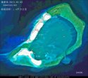
Image of Chigua Island on 24 Jan 2015.
On the top, we can see that the new building dwarfs the original outpost. The new building is multiple storeys.
View attachment 11940
It doesn't look there is any airstrip?
It doesn't look there is any airstrip?
This is the image of Chigua (Johnson South) Island and there is no airstrip.
But I am pretty certain there is going to be airstrips on Yongshu (Fiery Cross) and Subi Islands.
Let's wait and see.
antiterror13
Brigadier
do you think the final area would be as big as 7 sq km? ... it seems go that way
This is the image of Chigua (Johnson South) Island and there is no airstrip.
But I am pretty certain there is going to be airstrips on Yongshu (Fiery Cross) and Subi Islands.
Let's wait and see.

I went over some of my notes. There are likely to be airstrips on Meiji (Mischief) Island and Huayang (Cuarteron) Island. So, airstrips on Subi, Yongshu (Fiery Cross), Meiji and Huayang. Looking at this map, you can understand that these are the most logical positions. The Chinese have a grand plan and they are executing this plan.
do you think the final area would be as big as 7 sq km? ... it seems go that way
The size of the entire Subi reef is about 15 sq km. I think the final area would be about 3 to 4 sq km. That's my personal view not based on any evidence, just pure guessing.
.
Geographer
Junior Member
Thanks for the frequent photo updates, ahojunk. We all really appreciate them.
Google Earth has a new photo of Triton Island, the first in nine years. Recall that this is the island nearest the oil rig incident this past summer. The EEZ that China claims from Triton Island justified their oil exploration.

How would you evaluate the progress of their terraforming?
Does anyone have recent photos Taiping Island's new harbor?
Google Earth has a new photo of Triton Island, the first in nine years. Recall that this is the island nearest the oil rig incident this past summer. The EEZ that China claims from Triton Island justified their oil exploration.

How would you evaluate the progress of their terraforming?
Does anyone have recent photos Taiping Island's new harbor?
Last edited:
Geographer
Junior Member
What is the structure in the red square on Gaven Reef? It's in the 2012 Google Earth picture as well as some of the more recent construction photos of Gaven Reef.


Thanks for the frequent photo updates, ahojunk. We all really appreciate them.
@Geographer,
If you like the pictures and/or post, then can you please click on the "Like" button.
This is one way to show your appreciation and thanks.
.


