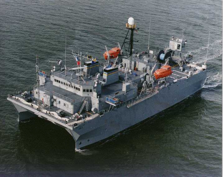
Surveying the oceans make it sound like a normal and legitimate, but for what purpose? Identifying sonar signatures of opposition subs, makes it sound like fun n games of old. It would be interesting to find out on how long the US has been surveying around Hainan island. Just recently because of the sub base? or for yrs
Long time. very long. I know that oceanographic surveys are needed for proper navigation and to find seaborne hazards such as underwater mountains, carvesses(Holes in the ocean) sunken vessels, etc. These things are hazards to navigation.
The Title should have been "U.S. ship is harrassing Chinese vessels near Chinese military base on Hainan island". .
The USNS ship was 125 miles from land. How were they doing what you alleged from that distance?
Did China send her ships to U.S. military base near U.S. waters to gather intelligence? NO
If they did an LA class SSN would be watching them.
Mods note. As a moderator I shall step out of this conversation. Please keep the level of discussion civil.
bd popeye super moderator
I went to navy.mil and could not pass these photos up..
SOUTH CHINA SEA (March 8, 2009) A crewmember on a Chinese trawler uses a grapple hook in an apparent attempt to snag the towed acoustic array of the military Sealift Command ocean surveillance ship USNS Impeccable (T-AGOS-23). Impeccable was conducting routine survey operations in international waters 75 miles south of Hainan Island when it was harassed by five Chinese vessels. (U.S. Navy photo/Released)
SOUTH CHINA SEA (March 8, 2009) Two Chinese trawlers stop directly in front of the military Sealift Command ocean surveillance ship USNS Impeccable (T-AGOS-23), forcing the ship to conduct an emergency "all stop" in order to avoid collision. The incident took place in international waters in the South China Sea about 75 miles south of Hainan Island. The trawlers came within 25 feet of Impeccable, as part of an apparent coordinated effort to harass the unarmed ocean surveillance ship. (U.S. Navy photo/Released)
Last edited:


