Steam cats are particularly inefficient. Steam is derived from the boilers and stored in steam accumulators to be used in the cats. Heat is lost from the pipes to the accumulators and from the accumulators to the cats as well as from the accumulators. Then there are the important pressure losses from the accumulators to the cats.I don't know what efficiency you are talking about because Steam power plant efficiency is between 37% to 44% for say 80MW The same efficiency as Gas Turbine of that size
You are using an out of date browser. It may not display this or other websites correctly.
You should upgrade or use an alternative browser.
You should upgrade or use an alternative browser.
PLAN Catapult Development Thread, News, etc.
- Thread starter antiterror13
- Start date
Hendrik_2000
Lieutenant General
Steam cats are particularly inefficient. Steam is derived from the boilers and stored in steam accumulators to be used in the cats. Heat is lost from the pipes to the accumulators and from the accumulators to the cats as well as from the accumulators. Then there are the important pressure losses from the accumulators to the cats.
All those accumulator and pipes are insulated ! to minimized loss. Pressure drop loss can be minimized
PiSigma
"the engineer"
I don't know enough about ship steam to comment. But in the O&G industry, we use high pressure steam around 10-15 MPag. Produced steam is usually 75-80% quality and then get the water knocked out near the users. Heat losses over 5km will only reduce the quality of steam by maybe 3-4% even in -30C weather if properly insulated (remember steam is travelling at 5-10 m/s so not much time spend in the elements).
Of course they are carefully designed and maintained. But a characteristic of the function is the intermittent use and that give additional losses of heat and pressure. And there is the loss out of the cats themselves. EM cats are more efficient.All those accumulator and pipes are insulated ! to minimized loss. Pressure drop loss can be minimized
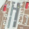
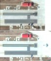
I went through posts from November 2016 to today, it seems that nobody has mentioned the updated google earth photos. Here is what I saw, taken on November 28th, 2016
It seems that the UAV is purposefully placed at the "narrow" launch track. If we assume that steam cat is not able to dial down to launch UAVs, then the narrow track should be EM cat.
Funny thing is that, at the very beginning, the Shanghai site was said to be EM cat until the discovery of Wuhan site which is broader. So some people switched Shanghai site to be Steam because Wuhan is most certainly EM because of Admiral Ma. Even though there is no new information to connect Shanghai facility to any institute that is specialized in steam, actually the institute in Shanghai is more related to Ship electrical systems (I posted about that some time ago). To me, this is typical of adjusting known facts and observations to fit pre-determined conclusion.
From this photo, there is a chance that both tracks here are EM cat of different design, a wild guess is the difference in the energy storage sub-system. The narrow one is what was tested in Shanghai, the broader one is from Wuhan (a later tech). The "competition" is about whether the later (more advanced) version is as ready as the earlier version.
No matter which one win, their difference in effect to the ship is minimal. That will kill the argument of "design freeze" and "steam being more ready".

Or, the Shanghai track was for study and the Wuhan track is for production?I went through posts from November 2016 to today, it seems that nobody has mentioned the updated google earth photos. Here is what I saw, taken on November 28th, 2016
It seems that the UAV is purposefully placed at the "narrow" launch track. If we assume that steam cat is not able to dial down to launch UAVs, then the narrow track should be EM cat.
Funny thing is that, at the very beginning, the Shanghai site was said to be EM cat until the discovery of Wuhan site which is broader. So some people switched Shanghai site to be Steam because Wuhan is most certainly EM because of Admiral Ma. Even though there is no new information to connect Shanghai facility to any institute that is specialized in steam, actually the institute in Shanghai is more related to Ship electrical systems (I posted about that some time ago). To me, this is typical of adjusting known facts and observations to fit pre-determined conclusion.
From this photo, there is a chance that both tracks here are EM cat of different design, a wild guess is the difference in the energy storage sub-system. The narrow one is what was tested in Shanghai, the broader one is from Wuhan (a later tech). The "competition" is about whether the later (more advanced) version is as ready as the earlier version.
No matter which one win, their difference in effect to the ship is minimal. That will kill the argument of "design freeze" and "steam being more ready".
View attachment 37427
Could be, but unlikely because the Wuhan track's structure was drastically enlarged. We know the American tracks are quite narrow (in the same range as the Shanghai track), The Wuhan track is almost double in size, so besides linear motors there must be something bulky to be stuffed in I guess, making the two unlikely being of the same design.Or, the Shanghai track was for study and the Wuhan track is for production?
I wasn't suggesting that they were the same designs though. I meant study as in concept work and research.Could be, but unlikely because the Wuhan track's structure was drastically enlarged. We know the American tracks are quite narrow (in the same range as the Shanghai track), The Wuhan track is almost double in size, so besides linear motors there must be something bulky to be stuffed in I guess, making the two unlikely being of the same design.
I'd think from the look of it that the Shanghai design is a working design than conceptual because the narrow track in Huludao is in the same dimension as Shanghai.I wasn't suggesting that they were the same designs though. I meant study as in concept work and research.


