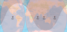
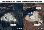
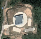
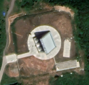
Finally James draws a rough illustration on how those radars could work on Google Earth.
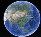
Few detail that he doesn't mention:
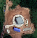
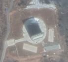
1. The Korla radar received an upgrade or once-a-decade maintenance at the end of 2021. It is the smallest EWR in terms of size, only half in length and width compared with other EWRs in China. It is also the oldest EWR in China so an upgrade is reasonable here.
Worth noting China doesn't often rotate the radar towards the direction of Russia, could it be some secret agreements on mutual trust or even possibly early warning sharing network between China and Russia?
2. "SSBN will carry out a decapitation strike from Indian Ocean, Chinese can't detect it and they will be screwed."
First of all, TJS-2 was the first one in Chinese EWS series and almost cover the entire Indian Ocean in 2017, then it came with TJS-5 over Singapore in 2020. Both of them were placed over Asia instead of US Minuteman III silos. My guess is that PLASSF tested the reliability of EWS system by using them to track China's own ballistic missile tests. Side bet is to cover vulnerable areas where hadn't been dealt with EW radars yet at that moment.
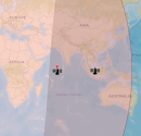
Mystery:
Russia doesn't have even one GEO EWS in their EW system, wouldn't it be vulnerable against a first strike from Indian Ocean if they require dual phenomenology. (meaning they need confirmation from both radars and satellite to order a dispersal or counter strike)
It makes me wonder if China and Russia are developing a joint BMD warning system and Putin explicitly said in 2019 that Russia was helping China to develop its EWS. It makes sense to combine Chinese and Russian EW coverage in technicality but not so sure on geopolitics issue.

