PLAN SCS Bases/Islands/Vessels (Not a Strategy Page)

Zetageist

Junior Member
Just some light readings for you guys regarding SCS and Okinotorishima Islands published last year when the Chinese reclamations started in SCS:

South China Sea: How Many Battalions Does the Passive Voice Have?
And...Island Games: Okinotorishima vs. Johnson South Reef
Please, Log in or Register to view URLs content!


Japan extends its sea territory by 177,000 sq km in line with UN ruling
Please, Log in or Register to view URLs content!


It would be funny to see if China were to build the exact same looking concrete platforms as Okinotorishima ones to protect 2 rock outcrops on the Fiery Cross Reef. One rock is 1 meter above high tide located on SW end (9˚33'N 112˚53'E), and the other one is 0.6 m above high tide at NE region of the reef.
 
Last edited:

Zetageist

Junior Member
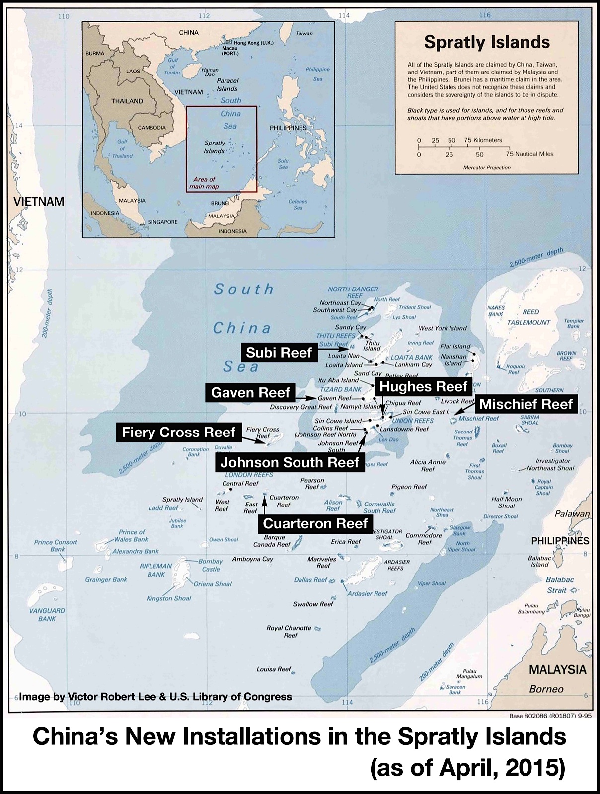
China's Spratly holdings with big labels:

thediplomat_2015-04-25_02-45-12.jpg
 
Just some light readings for you guys regarding SCS and Okinotorishima Islands published last year when the Chinese reclamations started in SCS:

South China Sea: How Many Battalions Does the Passive Voice Have?
And...Island Games: Okinotorishima vs. Johnson South Reef
Please, Log in or Register to view URLs content!


Japan extends its sea territory by 177,000 sq km in line with UN ruling
Please, Log in or Register to view URLs content!


It would be funny to see if China were to build the exact same looking concrete platforms as Okinotorishima ones to protect 2 rock outcrops on the Fiery Cross Reef. One rock is 1 meter above high tide located on SW end (9˚33'N 112˚53'E), and the other one is 0.6 m above high tide at NE region of the reef.

It just shows how irregular so-called "standards" are.
 

no_name

Colonel
It would be funny to see if China were to build the exact same looking concrete platforms as Okinotorishima ones to protect 2 rock outcrops on the Fiery Cross Reef. One rock is 1 meter above high tide located on SW end (9˚33'N 112˚53'E), and the other one is 0.6 m above high tide at NE region of the reef.

I thought they are making whole islands.
I think concrete barriers have been put up outlining the current land fill.
 

ahojunk

Senior Member
China is now complaining about the Vietnamese and Filipinos...

----------------
Please, Log in or Register to view URLs content!

English.news.cn 2015-04-29 19:02:01

BEIJING, April 29 (Xinhua) -- China told the
Please, Log in or Register to view URLs content!
and Vietnam on Wednesday to halt all intrusive action on China-owned islands in the
Please, Log in or Register to view URLs content!
, following its rejection of concerns voiced by
Please, Log in or Register to view URLs content!
.


Some reports said the chairman's statement at the 26th ASEAN Summit, which expressed concern over China's activities on the islands, ignored the large-scale reclamation and military buildup by certain ASEAN members in the South China Sea.

Defending China's building activities, Foreign Ministry spokesperson Hong Lei on Tuesday said China's construction activities on the Nansha Islands are within the scope of China's sovereignty, which is unimpeachable.

The Philippines and Vietnam are illegally occupying islands and reefs that are part of China's Nansha Islands, where they have built fixed facilities like airports, reclaimed land and even deployed offensive weapons like missiles, Hong told reporters on Wednesday.

"China expresses grave concern and strong opposition to these illegal activities," Hong said, urging relevant countries to "immediately stop all action and words that infringe upon China's sovereignty and interests."

The Philippines has built an airport and dock on Zhongye Dao, Nansha Islands, while constructing tourism facilities there and on another two islands, Mahuan Dao and Feixin Dao, according to Hong.

The Philippines' stranded warship near the Ren'ai Reef has served as a permanent installation since 1999 in an attempt to seize the reef, he said.

Vietnam has undertaken large-scale reclamation work on more than twenty islands and reefs belonging to Nansha Islands, building ports, runways, missile positions, office buildings, camps, hotels and lighthouses, the spokesperson said.

Vietnam has also built a number of houses and helicopter platforms on Wan'an Tan, Xiwei Tan, Lizhun Tan and Aonan Ansha, Hong added.
 

Zetageist

Junior Member
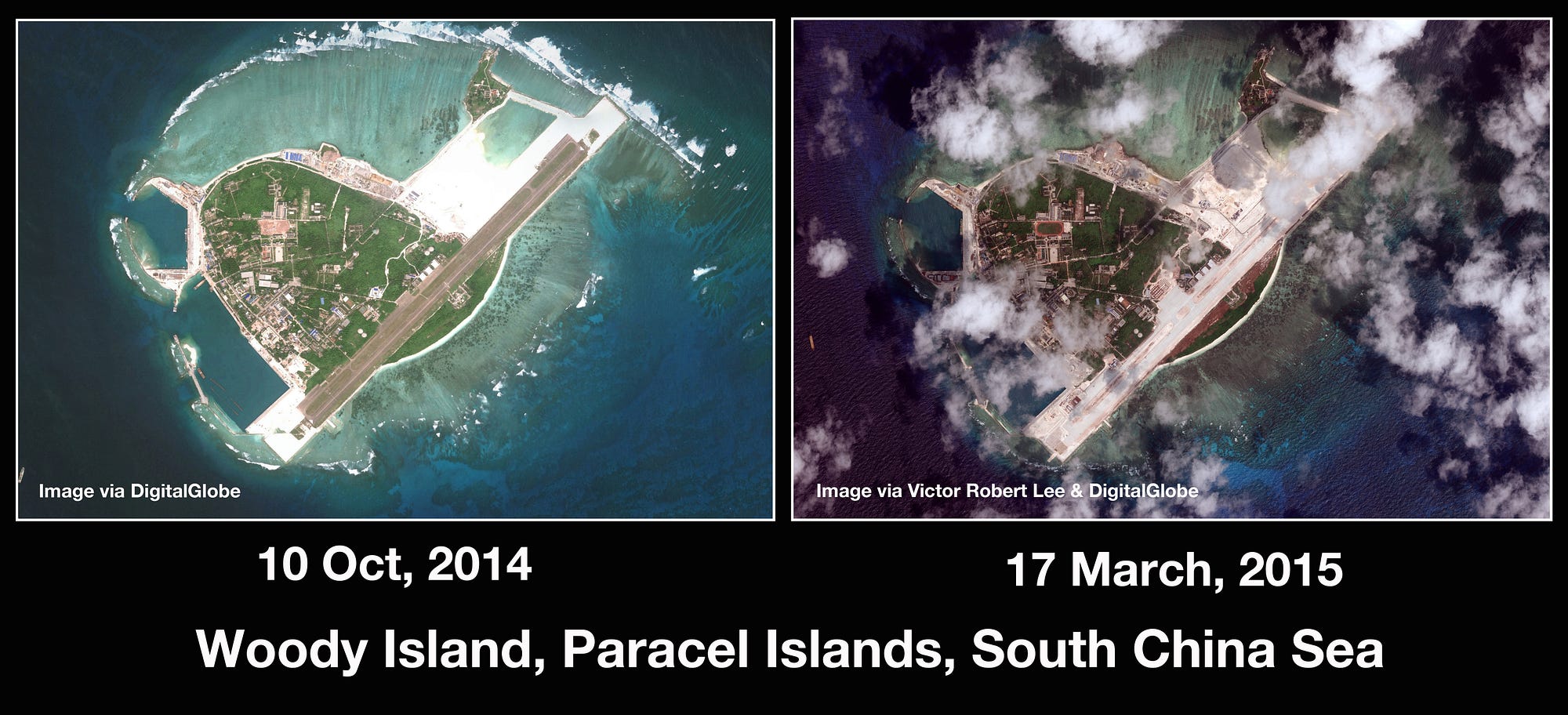
1*XL0S4xvhmr9w_60xK1j7MA.jpeg


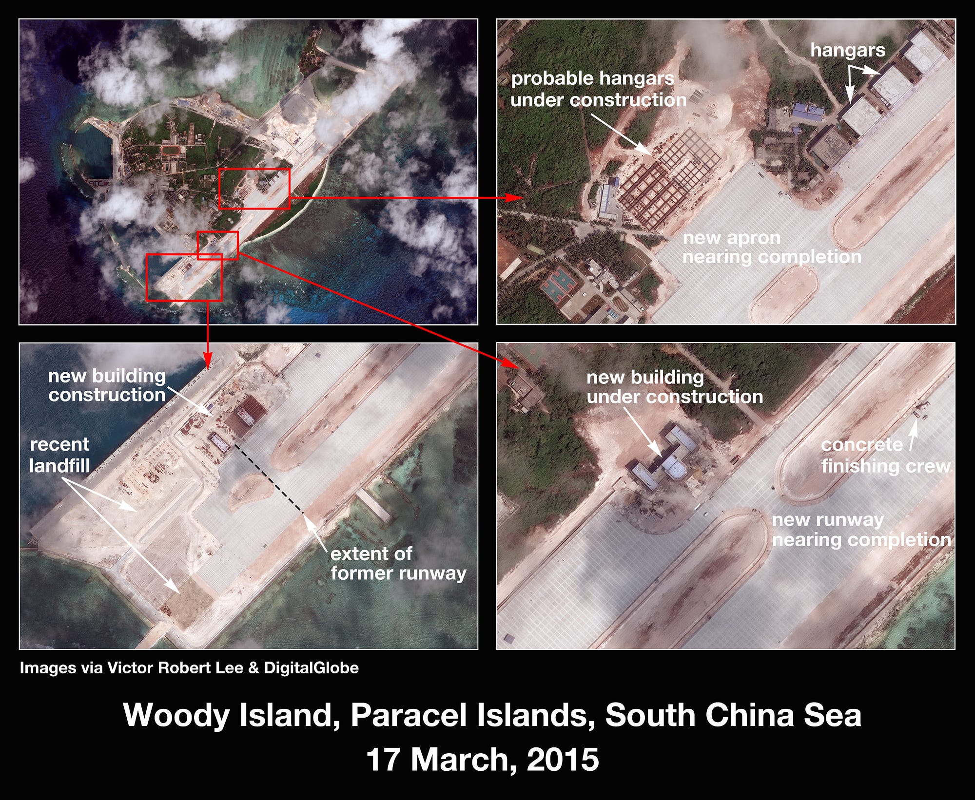
1*KHfFXpiCEQyFfSe5odT6YQ.jpeg


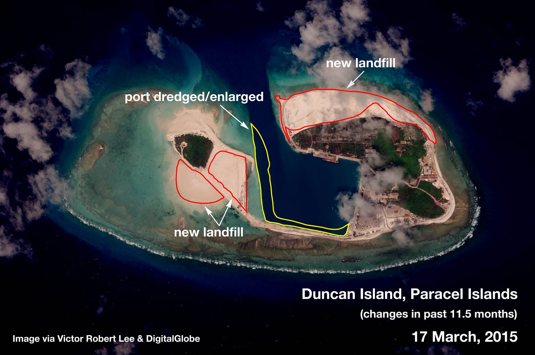
One thing I noticed about the reclamation done on Duncan Island is that there was no dredger/ship around the island other than two ships by the dock, while with the reclamations of Spratly Islands we did see a lot of dredgers/ships around those islands.

1*tzT3aKfqO8jzwnx9S4CCEw.jpeg
 
Last edited:

lcloo

Captain
Regarding Duncan island, the ship in the photo looked like sand carrier ship. So it looked like they brought the sand from elsewhere, probably from the mainland. That is, beside the sand that was dredged from enlarging the harbour.
 
Last edited:

Geographer

Junior Member
Icloo, that ship probably brought the materials for making concrete which cannot be dredged.

How does the extended runway affect operations? What new types of aircraft can land and takeoff? What is the effect on payload?
 
Top