Only " Tibet Water to Xinjiang Project" can save China from severe economic&social unrest

tidalwave

Senior Member
Registered Member
I'm wondering what exactly is the paste from:
and I'm also wondering how long the 200 hectares oasis from:

will last

had this "paste" worked forever, it would've turned Taklamak into California, yes LOL

actually, no need forever, once the tree and plants are mature enough it will take over and their roots will pull those soil together.
 
actually, no need forever, once the tree and plants are mature enough it will take over and their roots will pull those soil together.
well Chinese tried to grow rice here (you might translate this:
Please, Log in or Register to view URLs content!

if you thought I was making stuff up); they had been trying for several years, completely serious ... then blamed an extreme heat during one summer

(Czech Rep. has 'continental influenced' climate which during summer means pretty much anything between 50 F, which would in fact be 'maritime', to 100 F if the air comes down from Sahara which is the other continent LOL! right now it's ... 72 F, at noon)

and they said their experts didn't get visas, so they quit ... it sounded like a nonsense all the time, as far as I know the nearest rice fields are in Italy which is south to the Alps ... back to Taklamakan, I totally doubt it could feed the number of people you said Yesterday at 1:05 AM

I'm not going to post about it any more
 

SilentObserver

Junior Member
Registered Member
just not to loose track here:
  1. "The Taklamakan Desert has an area of 337,000 km2 ..."
    Please, Log in or Register to view URLs content!
  2. "German territory covers 357,021 km2 ..."
    Please, Log in or Register to view URLs content!
  3. Area • Total (423,970 km2)
    Please, Log in or Register to view URLs content!
EDIT to rephrase, Today at 7:11 PM I said #1 = #2, and also said a miracle would be needed for #1 to become as fertile as #3
The project is called 红旗河 or "red flag river" (just a direct translation) and will include more than just the area of Taklamakan Desert. The river project would have multiple branches going to Xinjiang (Kashgar in the South and Turpan in the North), Inner Mongolia and Yellow River baisin.

1520061153703.jpg
23914924DF557BFBA2C3D534F62F846A018DFF95_size64_w550_h387.jpeg

The main areas it would directly affect are:
  1. Taklamakan Desert (337,000 km2)
  2. Please, Log in or Register to view URLs content!
    (48,000 km2)
  3. Creation of
    Please, Log in or Register to view URLs content!
    green belt, basically most of Gansu and parts of Western Inner Mongolia (200km*1000km = 200,000km2 as stated by the experts behind the project). There's been talks of creating multiple large ecological corridors (wide tunnels and bridges for animals) to allow migration of animals between Tibet, Xinjiang, Altai region, Mongolia, and Siberia since the new new green belt would ecologically connect the regions and the new river would create a barrier.
  4. Please, Log in or Register to view URLs content!
    (640,000 km2) this area won't be entirely creating green areas from the desert as farming already exists in most of this area but it would greatly increase yields and yield stability. Currently parts of this region suffers from occasional droughts.
  5. Inner Mongolia in the long run would have parts forested and other parts turned into grasslands/wetlands. This area could be more than 500,000 km2.
In just the Western regions of Xinjiang and Gansu the major greenification areas would amount to 585,000km2 (larger than Spain and slightly smaller than Ukraine, roughly the size of Madegascar). Lakes would form in the Tarim and Hami-Turpan basins. In addition 640,000km2 of the Loess Plateau water supply would be increased. Inner Mongolia would have a new water supply. The indirect effect would be the increased rain fall of the entire Western and Northern frontier region of China area totalling more than 2 million km2. Downstream areas towards the East would benefit as well as smaller basins in western and northern regions.

The culmination of these branches essentially completes the Three North Shelter Forest Program which is projected to be complete by 2050.
Please, Log in or Register to view URLs content!

241119C900000578-2874368-image-m-6_1418643273060.jpg
 
Last edited:
almost missed being quoted here ... I used the word "miracle" when commenting on turning Taklamak into California in the previous page, now got this:
The project is called 红旗河 or "red flag river" (just a direct translation) and will include more than just the area of Taklamakan Desert. The river project would have multiple branches going to Xinjiang (Kashgar in the South and Turpan in the North), Inner Mongolia and Yellow River baisin.

View attachment 47798
View attachment 47802

The main areas it would directly affect are:
  1. Taklamakan Desert (337,000 km2)
  2. Please, Log in or Register to view URLs content!
    (48,000 km2)
  3. Creation of
    Please, Log in or Register to view URLs content!
    green belt, basically most of Gansu and parts of Western Inner Mongolia (200km*1000km = 200,000km2 as stated by the experts behind the project). There's been talks of creating multiple large ecological corridors (wide tunnels and bridges for animals) to allow migration of animals between Tibet, Xinjiang, Altai region, Mongolia, and Siberia since the new new green belt would ecologically connect the regions and the new river would create a barrier.
  4. Please, Log in or Register to view URLs content!
    (640,000 km2) this area won't be entirely creating green areas from the desert as farming already exists in most of this area but it would greatly increase yields and yield stability. Currently parts of this region suffers from occasional droughts.
  5. Inner Mongolia in the long run would have parts forested and other parts turned into grasslands/wetlands. This area could be more than 500,000 km2.
In just the Western regions of Xinjiang and Gansu the major greenification areas would amount to 585,000km2 (larger than Spain and slightly smaller than Ukraine, roughly the size of Madegascar). Lakes would form in the Tarim and Hami-Turpan basins. In addition 640,000km2 of the Loess Plateau water supply would be increased. Inner Mongolia would have a new water supply. The indirect effect would be the increased rain fall of the entire Western and Northern frontier region of China area totalling more than 2 million km2. Downstream areas towards the East would benefit as well as smaller basins in western and northern regions.

The culmination of these branches essentially completes the Three North Shelter Forest Program which is projected to be complete by 2050.
Please, Log in or Register to view URLs content!

View attachment 47801
I don't know a stronger word than "miracle" though
 

tidalwave

Senior Member
Registered Member
almost missed being quoted here ... I used the word "miracle" when commenting on turning Taklamak into California in the previous page, now got this:

I don't know a stronger word than "miracle" though

Depending upon from which perspective, to some it's impossible while to some is a piece of cake.
 
now noticed the tweet
Please, Log in or Register to view URLs content!

Please, Log in or Register to view URLs content!


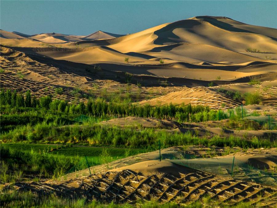
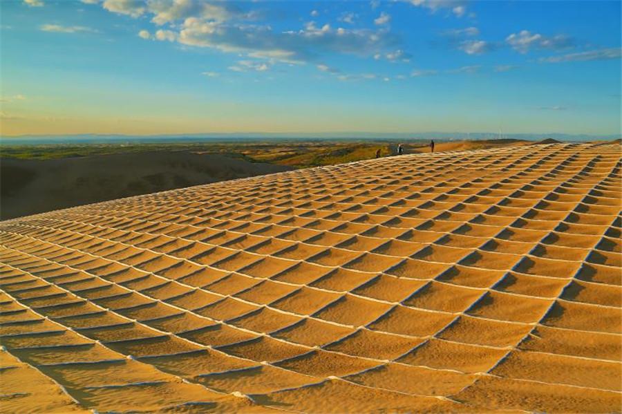
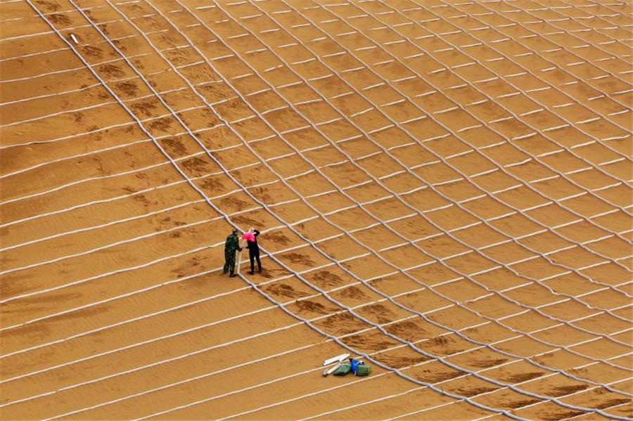
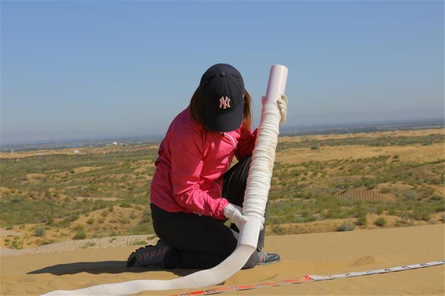
Turning desert green: The use of degradable material by sand barrier technology is helping transform hundreds of acres of Inner Mongolia's
Please, Log in or Register to view URLs content!
Desert into green landscape in an environment-friendly way

Diy_0g3WAAEIsYL.jpg

Diy_0g6XsAEsG8_.jpg

Diy_0gvXcAUysay.jpg

Diy_0g5XkAEDrQ7.jpg
 

solarz

Brigadier
It seems that in the 21st century, only China has the courage and vision to apply new technologies in revolutionary projects. While the West is stuck oohing and aahing over the latest smart phone or dropping bombs on 3rd world countries, China is doing things that will transform the world.
 

taxiya

Brigadier
Registered Member
A few things to be clear before getting excited.

The "red flag river" is NOT a project, it is a preliminary study by some scientists. Although they are members of state institutions, their study is not founded by state. That means there is NO project which has to be a state founded or lead project with a budget through state consul.

It has nothing to do with "South–North Water Transfer Project" which is ongoing, it is neither an extension, nor the western section of it.

South–North Water Transfer Project was envisioned by Mao in 1952, it began implementation in 2002, 50 years after the idea was proposed. The western section is not even started. The project is expected to be finished by 2050, almost a hundreds years after proposal.

The "red flag river" idea has been floated in less than 2 years. If it ever got enough attention, and put in action, it will be around 50 years from now. Not because China can not do it faster, it is because extreme care has to be taken to make decision on such scale. 50 years from now, most of us in this forum will not be around.

So I will advice a word from Mao "一万年太久,只争朝夕", "10 thousands years is too far, do what we can do today". Long term planning is essential, but putting too much focus on super long, super costly and super risky "dream" is not really "keep feet on the ground"/"脚踏实地".
 

solarz

Brigadier
A few things to be clear before getting excited.

The "red flag river" is NOT a project, it is a preliminary study by some scientists. Although they are members of state institutions, their study is not founded by state. That means there is NO project which has to be a state founded or lead project with a budget through state consul.

It has nothing to do with "South–North Water Transfer Project" which is ongoing, it is neither an extension, nor the western section of it.

South–North Water Transfer Project was envisioned by Mao in 1952, it began implementation in 2002, 50 years after the idea was proposed. The western section is not even started. The project is expected to be finished by 2050, almost a hundreds years after proposal.

The "red flag river" idea has been floated in less than 2 years. If it ever got enough attention, and put in action, it will be around 50 years from now. Not because China can not do it faster, it is because extreme care has to be taken to make decision on such scale. 50 years from now, most of us in this forum will not be around.

So I will advice a word from Mao "一万年太久,只争朝夕", "10 thousands years is too far, do what we can do today". Long term planning is essential, but putting too much focus on super long, super costly and super risky "dream" is not really "keep feet on the ground"/"脚踏实地".

Thank you for these additional details.

I don't think "red flag" can only be done 50 years from now though. The South-North Water project took 50 years because China was not capable of carrying it out earlier. It's different now. I don't think it will happen fast, but I don't think it will take another 50 years either.

Desert reclamation is happening even now, and China is deploying a variety of technologies in pursuit of that goal. Some will inevitably fail, but others may yield promising results. Maybe it's not as grand as what "red flag" is promising, but bit by bit, the Gobi desert is turning into a grassland.
 
Top