Crazy to think that so far 161 rockets have been launched this year globally! Seems like we are entering a new era of space exploration!
That’s just orbital launches right?
Crazy to think that so far 161 rockets have been launched this year globally! Seems like we are entering a new era of space exploration!


That’s just orbital launches right?
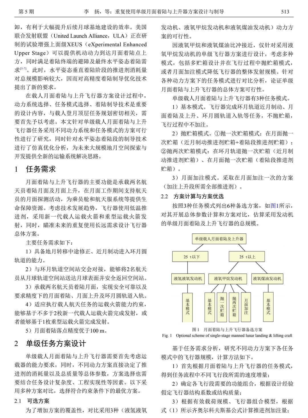
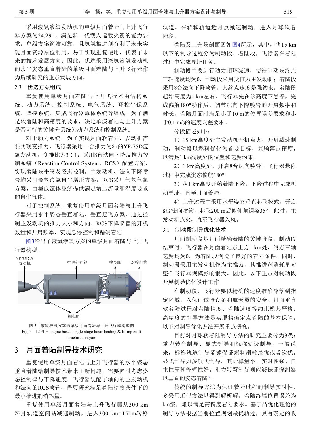
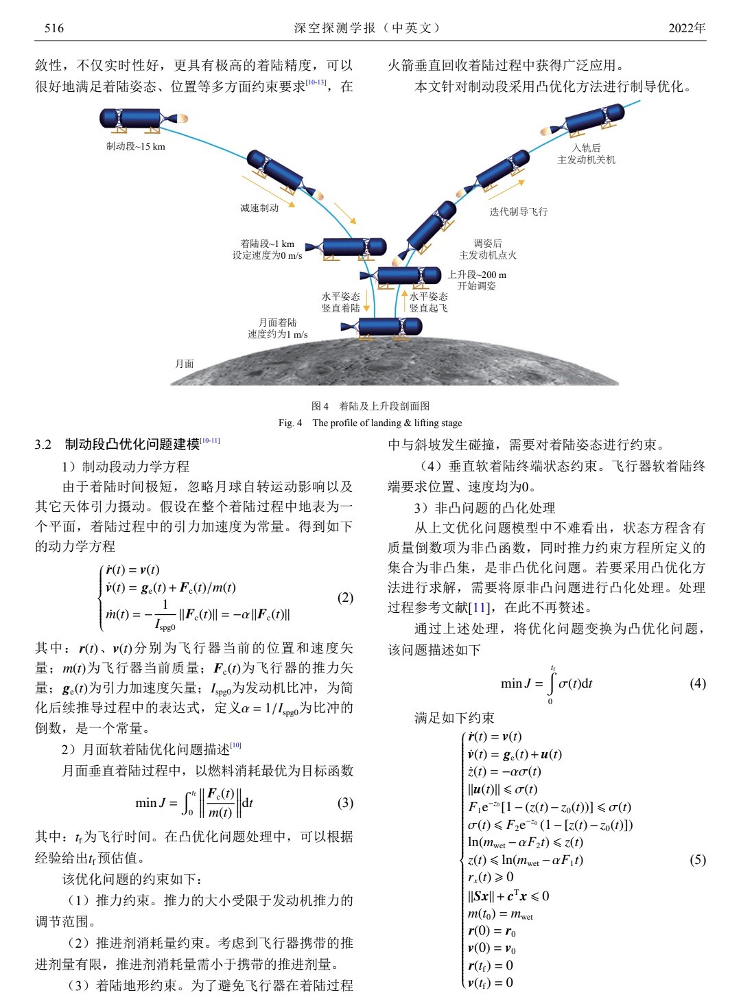
What could be the possible advantage of landing horizontally vs vertically?
For a very large lander, landing vertically means you need to climb down a very tall ladder to get on the ground. Things become impractical.What could be the possible advantage of landing horizontally vs vertically?


为抢抓商业航天赛道新机遇,抢占遥感应用、满足秦岭保护、智能绿色城市建设等未来市场的需求,11月18日,西安航空航天投资股份有限公司秦岭小卫星星座项目正式宣布启动。
秦岭小卫星星座项目集高时间分辨率、高空间分辨率、大幅宽的高光谱卫星、光学遥感卫星以及SAR遥感卫星等多手段一体,由128颗卫星组成,将分两期建设完成。
据了解,围绕航天领域产业发展,西安航投先后在运载火箭、卫星发射等航天基础设施及服务领域进行前期布局,2022年8月10日,已成功发射“西安航投一号”卫星,建设完成西安航投卫星数据中心,开展GIS遥感测绘数据服务,为此次星座项目打下了良好基础。
星座建成后,将针对秦岭保护、自然资源监测、环保监测、农业林业、应急管理、智慧工地、气象水文、减灾救灾、金融保险等领域,为陕西省尤其是西安境内提供任意目标高频次的重访监测,可便捷、快速满足用户及物联网领域市场需求。
在经过西安光机所充分的技术论证、西安航投对卫星应用及运营平台详细的市场调研及商业模式分析后,秦岭小卫星星座项目将确保项目可实施、有前景、有市场。
此次西安航投通过与国内领先的科研院所团队合作,创新性完成了以光学载荷为中心的整星设计,使整个系统性能优化;建立了遥感高光谱大数据智能应用处理,形成天空地一体化的大气监控方式,构建立体化环境监测网,形成大气监测精细化管理体系;同时构建了高光谱成像技术及图像处理分析。
关键技术突破了干涉型高光谱成像技术、高分辨可见光空间信息获取和光学遥感技术、新型自由曲面光学成像技术、在轨可展开望远镜技术等。随着技术不断成熟,此次突破将拓展航天产业商业应用领域。
The Qinling Small Satellite Constellation Project integrates high time resolution, high spatial resolution, large-scale wide hyperspectral satellites, optical remote sensing satellites, and SAR remote sensing satellites. It consists of 128 satellites and will be completed in two phases.
It is understood that around the development of the aerospace industry, Xi'an Aviation Investment has successively carried out preliminary layout in the space infrastructure and service fields such as carrier rockets and satellite launches. On August 10, 2022, the "Xi'an Aviation Investment No. 1" satellite has been successfully launched. The completion of the Xi'an Aviation Investment Satellite Data Center and the development of GIS remote sensing surveying and mapping data services have laid a good foundation for the constellation project.
After the constellation is completed, it will provide Shaanxi Province, especially Xi'an, with any target high-frequency data for Qinling protection, natural resource monitoring, environmental monitoring, agriculture and forestry, emergency management, smart construction sites, meteorology and hydrology, disaster reduction and relief, financial insurance and other fields. Revisiting monitoring can conveniently and quickly meet the needs of users and the market in the field of Internet of Things.
