You are using an out of date browser. It may not display this or other websites correctly.
You should upgrade or use an alternative browser.
You should upgrade or use an alternative browser.
China's Space Program Thread II
- Thread starter Blitzo
- Start date
escobar
Brigadier
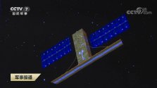
Military meteorological sat carrying an Interferometric Imaging Radar Altimeter (InIRA). This spaceborne wide-swath ocean radar altimeter was tested on board Tiangong-2 lab and can perform imaging and acquire elevation information simultaneously. The in-orbit observation results of Tiangong-2 InIRA demonstrate that it is capable of measuring the dynamic sea surface height with wide swath, sea waves of different scales and sea winds, which greatly improve the observation and measurement efficiency compared with traditional nadir-looking radar altimeters.Another launch today. A Long March 6 rocket has successfully inserted the Yunhai-3 (云海三号) satellite into the pre-determined orbit. Sorry, but no high quality images of the launch are available at this time, but here are some pre-launch images to compensate.


China Space Station seen from Tianzhou-4
[Comments]
I still feel surreal that a Chinese space station is in the sky. I still remember the days when I was making model ships and planes in the youth clubs (少年宫). It was even beyond my wildest dreams that China one would build and operate a state-of-the-art space station all by itself. And by the look and feel, it is more state-of-the-art than the other big fat old space station. I love doing this poking because I hate the Wolfe amendment.


